Choosing between terrestrial laser scanning and mobile SLAM is often framed as an either-or decision.
It should not be.
Static and mobile scanning solve different parts of the same reality-capture problem. The better question is not which method is better overall. It is where each method delivers the most value on your project.
Z+F USA’s own technology reflects that approach. The IMAGER® 5024 family is built for detailed terrestrial capture, while the FlexScan 22® combines Z+F scan quality with a mobile SLAM platform designed for efficient coverage. The FlexScan 22® combines the advantages of static scanning with the efficiency of mobile systems.
For many projects, the strongest workflow uses both.
Start With Accuracy Requirements

Before choosing a scanner, define what the data needs to support.
Some areas demand tighter control because measurements, alignments, verification, or repeatability will directly affect downstream decisions. Others simply require reliable spatial coverage across a much larger footprint.
That distinction matters.
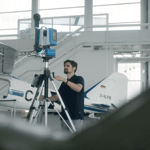
A terrestrial scanner such as the Z+F IMAGER® 5024 is well suited to areas where detailed stationary capture is the priority. Z+F’s 5024 family offers multiple configurations for different applications, with models designed around scan speed, field productivity, and quality data.
Instead of asking whether the entire project needs static scanning, identify the zones where the accuracy requirement justifies it.
Those may include equipment interfaces, structural connections, critical clearances, control geometry, or locations that will be measured again later.
Use the highest level of control where it matters most.
Use Mobile Scanning Where Coverage Dominates
Other areas of the project present a different challenge.
Large production floors, long corridors, infrastructure, warehouses, repetitive spaces, and expansive facilities may require broad coverage more than stationary capture from every position.
This is where mobile scanning can change the workflow.
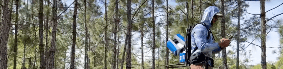
The Z+F FlexScan 22® is a mobile SLAM system designed to help teams move efficiently through large or complex environments while capturing high-quality 3D data.
Instead of stopping and setting up at every scan position, teams can move through the space and collect data continuously. That can significantly reduce field time when the project includes large areas where speed and coverage are the primary requirements.
The FlexScan 22® can support a range of environments, including industrial facilities, AEC applications, facility management, infrastructure, heritage documentation, and other built-environment projects.
For larger sites, that mobility can make a meaningful difference.
The objective is simple: use mobile capture where moving efficiently through the environment creates more value than establishing a stationary scan position at every location.

Anchor Critical Geometry With Terrestrial Scans
Mobile scanning does not eliminate the need for terrestrial capture.
In many projects, the two methods work best together.
A large industrial facility may include open production areas, long access routes, mechanical spaces, equipment cells, and critical interfaces within the same project. Those zones do not necessarily need the same capture method.
Terrestrial scans can establish a stronger reference around the areas where geometry must be controlled more tightly.
That may include:
- Equipment interfaces
- Structural connections
- Installation points
- Critical clearances
- Mechanical rooms
- Areas that will be compared over time
- Zones where detailed dimensional analysis is required
Mobile scanning can then extend coverage through the surrounding areas where speed and efficiency carry more weight.
This creates a more balanced capture plan.
The team is not overscanning every area at the highest level of control, and it is not relying on mobile capture alone where tighter geometric confidence is required.
Think in Zones, Not Scanner Types
A practical way to plan a mixed reality capture project is to divide the environment into three categories.
Precision Zones
These are areas where detail, control, or repeatability matter most.
Use terrestrial scanning to establish high-quality geometry for downstream measurement, verification, design, or coordination.
Coverage Zones
These are areas where speed and spatial coverage are the priority.
Use mobile SLAM to move efficiently through large, repetitive, or extended spaces.
Hybrid Zones
These are areas where both requirements exist.
Use terrestrial scans to establish critical geometry, then use mobile scanning to expand coverage around those reference areas.
This zone-based approach makes the capture strategy easier to justify.
Instead of asking which scanner is “better,” the project team can ask a more useful question:
What does this area need from the data?
That answer determines the method.
Use the Right Method for the Right Part of the Site
Consider a manufacturing facility preparing for a major retrofit.
A new piece of equipment may require tight verification around the installation area. Nearby structural columns, overhead utilities, piping, access clearances, and existing machinery may all need to be documented carefully.
That area may be a strong candidate for terrestrial scanning.
The same project may also require documentation of connecting corridors, adjacent production floors, utility routes, storage areas, or other larger spaces.
Those zones may be better suited for mobile capture.
Using both methods allows the team to focus higher-control scanning where it matters most while moving quickly through broader areas of the facility.
The result is a capture plan built around the project instead of around one scanner.
Keep the Data Moving After Capture
The scanning method is only one part of the workflow.
Once the data is captured, it still needs to be registered, processed, managed, measured, and prepared for downstream use.
Z+F LaserControl® supports point-cloud workflows including registration, filtering, measurement, and colorization. Data can then move into other 3D software environments for engineering, design, documentation, verification, and project coordination.
That becomes especially important when a project includes both terrestrial and mobile datasets.
The value comes from bringing those capture methods into a usable project workflow rather than treating them as separate exercises.
Field teams may use one method in a critical equipment zone and another across a large production floor, but the end goal remains the same: usable spatial data that supports the work ahead.
Match the Technology to the Requirement
There is no single capture method that fits every part of every project.
Terrestrial scanning delivers the control and detail needed for critical geometry.
Mobile SLAM provides the speed and coverage needed for larger, repetitive, or more expansive environments.
Many real-world projects need both.
That is why we recommend starting with the requirements of the site, dividing the environment into zones, and matching the capture method to each one.
Use terrestrial scanning where precision, detail, and repeatability are non-negotiable.
Use mobile scanning where coverage and field speed create the greater advantage.
Combine them when the project demands both.
With Z+F IMAGER® terrestrial scanners, the FlexScan 22® mobile platform, and LaserControl® software, teams can build a reality capture workflow around the project itself.
The better question is not static or mobile. It is where you need each one.